Niozelles is a commune in the Alpes-de-Haute-Provence department, in the Provence-Alpes-Côte d'Azur region, 6 km south-east of Forcalquier.
Its territory of 10 km² ranges from 354 to 603 m in altitude, in the heart of the Beveron valley and a few kilometers west of the Durance valley. The locality therefore belongs to the Monts du Vaucluse and the natural and tourist region of the Luberon.
The town has a green environment, 30% covered with forests, 10% with diverse vegetation, and 58% with varied crops.
Occupied since prehistoric times, the site of Niozelles was endowed with a castle motte at the top of a hill shortly before the year 1000, which would become a small seigniorial castle in the 11th century. Developed around a first village corresponding to the current place called "Vieille-Eglise". In fact, a church was built there, depending on the abbey of Saint-André de Villeneuve-lès-Avignon. From the 16th century, after an epidemic, a new village developed below the hill, still around a seigniorial castle. The seigniory has passed through the hands of different families over the centuries…
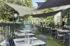
Today, the town has retained a picturesque character and an interesting heritage. If the vine is no longer cultivated, Niozelles has labels that guarantee and protect its production of olive oil, spelled, honey, cheeses... The charm of the village (which has nearly 300 inhabitants) and its typical Luberon environment makes it a popular stopover or even a vacation spot, close to other major tourist sites...
The panoramic views enjoyed over the surrounding countryside are not the only attraction of the new village which stretches along the road to Forcalquier.
Thus, in the centre, the seigniorial castle rebuilt in the 16th and 17th centuries is a major heritage point of interest, with its rectangular plan and its massive appearance. Note that one of the two corner towers of the facade has disappeared. On the other hand, the openings are arched. In addition, the gate which gives access to the backyard (where a fountain has been fitted) has a keystone on which is inscribed the date of 1768, which corresponds to the neo-classical style of the last alteration of the residence. … Inside, plasterwork decorations have been preserved. The ensemble now evokes a noble Provençal bastide...
Dedicated to the Invention of Saint-Etienne, the parish church is dated 1681 (nave with groined vaulted bays and facade) but the choir and the right aisle are earlier (14th century, before the town center was moved...). We also observe that the bell tower consists of a tower attached to the choir.
The last vestige of the first village, at a place called the "Vieille-Eglise", a demolished keep from the 13th century now bears witness to the small fortress of yesteryear...
Beautiful old houses still dot the little town, whose southern door once made it possible to connect, via a staircase, the castle to the cultures and via a vaulted passage, the village to the washhouse...
Once discovered this picturesque building, place to relax with the water level of the Mill de Ventre, a few kilometers to the east, which is not suitable for swimming but allows you to cool off, while proving to be a place for wooded and shady walks appreciated when you go around it in the summer...
Several hiking trails are available on the territory (covered with forests on its southern half). Let us mention "The tour of the vines" which connects Niozelles to the village of Pierrerue (6 km long and accessible to a family audience). It allows you to observe the old plots of vines in the locality delimited by dry stone walls. We now take the opportunity to notice the other crops (cereals, lavender, olive groves). Moreover, this route or others are dotted with truffle fields and sheep and goat farms where one of the prides of the town is produced, the "banon", a soft cheese with a natural rind, or Provence honey.
Other hiking or mountain biking loops lead to Forcalquier or join a larger network that extends over the Luberon. Maps and information on +33 4 92 75 10 02.
Note for the youngest the plateau and multisport ground of the municipality (information in town hall and on +33 4 92 75 31 67) and that throughout the year, and has especially in summer, the Luberon Regional Natural Park schedules events, workshops, exhibitions or thematic hikes. Join +33 4 90 04 42 00.