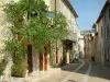
Beautiful and easy walk with children through the woods and over the rocks, 360° view from the summit. Total length: 3½ hours

The Préalpes d'Azur Regional Natural Park
Beautiful and easy walk with children through the woods and over the rocks, 360° view from the summit. Total length: 3½ hours

| Department | Alpes-Maritimes |
|---|---|
| Departure municipality | Thorenc |
| Outing type | Hike |
| Difficulty | Intermediate |
| Duration | 3:30 |
| Recommended period | from january to december |
| Environment | Mountains |
| Kilometres | 8 km |
| Altitude upon departure | 1250m |
| Change in altitude | 400m |
From the village centre, the path is signposted in full by the Departmental Council.
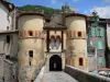
Continue towards the Schools - marker 128 - (Avenue du Belvédère), and after 500 m turn left, pass the reservoir and make your way to the crossroads and follow the signs for the Bleine Pass (130). When you arrive at the pass, you will find a historic monument. Follow the yellow markers through the forest to the DFCI (water reserve for fires), continue along the ridge and arrive at the Peak of the Eagle: 360° view over the Mercantour, the Argentera and the sea (Lérins islands).
Descend along the ridges to the TV antenna (take-off spot for paragliders, then continue to the Bleine Pass and return along the path uphill. At marker 130, turn left and descend behind the village.